Wednesday, January 1, 2020

How Many Types Of Plains Are There In Geography?

A plain located at great depths on the floor of the ocean is called an abyssal plain.

In geography, a plain refers to a flat area with little or no changes in elevation. It is one of the world’s major landforms. Plains are usually found at the foot of mountains, by the coasts, at valley bottoms, or on the upper surface of plateaus. Plains are often the most densely inhabited places in the world. The relative ease of transport along level land favors human settlement. Plains in many parts of the world are important for agriculture. Interestingly, plains also occur underwater where they constitute part of the seafloor. Such plains are called abyssal plains. In this article, we take a look at the different types of plains and their mechanism of formation.

Outwash Plain

Also called a sandur, an outwash plain is formed by glaciers. Such a plain is formed when a glacier deposits sediments at its terminus. As a glacier moves, it erodes the bedrock and carries the eroded sediments downstream. These sediments are deposited by the meltwater of the glacier at the snout. Outwash plains are a common landform in Iceland. The Skeiðarársandur in Iceland is the world’s largest outwash plain with an area of 1,300 square km.

Till Plain

A till plain is also a plain formed by glacial action. Such plains are formed by the deposition of glacial till (unsorted glacial sediment). When a sheet of glacial ice gets detached from the main glacier and melts in place, the sediments are deposited on the ground to result in the formation of a till plain. Such plains can be seen in northern Ohio where they were created by the Wisconsin glaciation.

Lava Field

A lava field can also be referred to as a lava plain. Such a plain is formed by the accumulation of layers of lava. The lava plains can stretch for miles and are easily visible from the air or in satellite images where they appear darker in color than the surrounding landscape.

Lacustrine Plain

Lacustrine plains are formed in areas previously occupied by lakes. When a lake drains out completely due to factors like evaporation, natural drainage, etc., the sediments remain behind on the lakebed to form a plain. Such lacustrine plains might be highly fertile and support agriculture or might form a wetland or even a desert depending on the composition of the sediments. Lacustrine plains are common in Southern Indiana of the US where such plains are found in areas formerly occupied by proglacial lakes. The Kashmir Valley of India is also an example of a lacustrine plain.

Scroll Plain

Scroll plains are formed in areas where a river meanders across a low gradient. Deposition of sediments at such locations results in the formation of a plain. Oxbow lakes are common occurrences in such areas. The Taieri River forms a spectacular scroll plain near Paerau in New Zealand.

Flood Plain

A floodplain refers to a plain that stretches from the banks of a river or stream to the enclosing valley walls. Floodplains are usually subjected to flooding when the adjacent water body overflows. The plains are often fertile and are made of deposits of silts, sands, levees, etc., deposited by floodwaters. Floodplains usually support a rich ecosystem. Many densely populated cities are located on these plains. However, many of the most devastating floods in history have taken place in floodplains. The Yellow River’s floodplains is one such area that is frequently subjected to deadly floods.

Alluvial Plain

Alluvial plains are vast, sweeping stretches of plain land that are formed by the deposition of sediments called alluvium. An alluvial plain usually includes floodplains as part of its area but extends beyond such plains. An alluvial plain represents the pattern of floodplain shift over geological time. As a river flows down mountains or hills, it carries sediments resulting from erosion and transports the sediments to the lower plain. As the sediments build up over time, the elevation of the floodplain increases while the width of the river channel decreases. Unable to bear the pressure, the river now looks for an alternative course with a higher channel capacity. Thus, the river forms a meander and flows through a new channel. In this way, floodplains continue growing and adding up to form massive stretches of alluvial plains. The Indo-Gangetic Plain in India and the Po Valley in Italy are examples of alluvial plains.

Abyssal Plain

A plain located at great depths on the floor of the ocean is called an abyssal plain. Such plains can be found at depths ranging between 9,800 ft and 20,000 ft. Abyssal plains comprise about 50% of the surface of our planet. These regions are some of the world’s least explored areas as well as the flattest and smoothest ones. The abyssal plains are massive in size. For example, the Sohm Plain of the North Atlantic Ocean covers an area of about 900,000 square km. Such plains are most common in the Atlantic Ocean but quite rare in the Pacific Ocean. Such plains are considered to be formed by the deposition of sediments, derived from land, in the abyssal depressions. Such deposition occurs in many layers till the underlying irregular features are smoothened out to result in a flat plain.

The post How Many Types Of Plains Are There In Geography? appeared first on Gradaxis.


source http://gradaxis.com/how-many-types-of-plains-are-there-in-geography/

from Dr. Linex https://ift.tt/36dCZkc
via IFTTT
What Is A Sound In Geography?

A sound in geography refers to an ocean or sea inlet with distinct characteristics that differentiate it from a bay, bight, fjord, or sea channel.

A sound is a marine geographic formation, which is located along coastlines around the world. It is characterized as an inlet of seawater that diverts from the main ocean and may take one of two forms. In the first form, the sound is formed by seawater that moves inland by way of a river valley, creating a type of harbor that is surrounded by tall hills and mountains. In the second form, the seawater may completely separate an area of land from a larger land mass, forming an island near the shore. In many cases, a sound is filled with several islands. The difference between these types of sounds is the number of entrances.

The term sound is often used interchangeably with other geographic terms, such as a bay or fjord. As previously mentioned, a sound may be formed when a river valley is flooded by seawater. It may also occur as the result of glacial erosion. The mountain sides reach far below the surface of the water. When the sound is located inland, the point further away from the ocean is often deeper than the area located closer to the open water.

Sounds Around The World

Sounds are located in many coastal countries around the world, although some countries have more than others. Below is a closer look at the countries with the largest number of sounds.

United States

The US is home to approximately 39 sounds, a large number of which are in North Carolina. One of the largest sounds in this state is the Albemarle Sound, which is located in the northern region of the coast. It is formed where the Roanoke and Chowan Rivers join together. The water within the sound is prevented from reaching the Atlantic Ocean by the Currituck Banks. This long, thin strip of land extends further north, creating the Currituck Sound, and further south, creating the Pamlico Sound.

Part of the water within the Albemarle Sound is protected as a herring management area, which is home to the blueback herring and the alewife. The majority of the fisheries of North Carolina are located in this sound, making it an important contributor to the state’s economy. The entire area makes up part of the Outer Banks area, which is a system of barrier islands that stretches for approximately 200 miles between North Carolina and Virginia.

Canada

Canada is home to around 29 sounds, many of which are located off the coast of the British Columbia province in the northwest. Howe Sound, which is located to the northwest of Vancouver, is one of these. It is characterized by its triangular shape and high mountains around its border. Additionally, this sound begins where the Strait of Georgia ends and ends at the city of Squamish in British Columbia. It runs for a length of just over 26 miles. The entire area has been of particular importance to the Shishalh and Squamish indigenous peoples throughout history.

Howe Sound contains several islands, the largest of which is known as Gambier Island. This island covers an area of 17,049 acres and is a popular destination for tourists in the area. Bowen Island has the largest number of permanent residents of any of the islands here, with a population size of around 3,680. During the summer, the population increases as many people stay here for vacation.

New Zealand

New Zealand has approximately 10 sounds. Of these, the largest is known as the Marlborough Sound. It is bordered to the south by South Island, to the west by Tasman Bay, and to the east by Cloudy Bay. Its location makes it difficult to access easily, which has resulted in a nearly non-existent human population. Prior to the colonial era, however, this area was home to Maori indigenous peoples. Today, the largest town bordering this sound is Picton, a port city that also sits at the beginning of the Queen Charlotte Sound.

The Marlborough Sound covers an estimated 1,200 square miles. Within this area are more than 50 protected natural reserves, many of which incorporate islands and islets. These reserves are home to many species, including the New Zealand king shag bird. This species is endemic to New Zealand and listed by the IUCN as vulnerable. The sound also supports a large fishing industry, which relies on species such as crabs and salmon. This industry and these species have been threatened in recent years by the use of ships and other water vessels.

Australia

Australia has at least 9 named sounds within its territory, nearly all of which are located off the coast of Western Australia. Camden Sound is located off the coast of the Kimberley region in the state of Western Australia, where it is surrounded by archipelago and reef formations. This sound is interesting because it hosts the largest breeding humpback whale population in the world, which is estimated at around 22,000 individuals. The humpback whales use this sound for breeding and to raise their young for the first several months, until leaving for colder waters elsewhere.

Camden Sound is not connected to the rest of the country by a roadway. The first European explorer in this area was Captain Phillip Parker King, who landed here in August of 1821. This sound is home to several islands, including: Champagny, Haywood, Rice Rocks, Bumpus, August, and Byam Martin. In 2009, this sound was designated as a marine park that covers 2,727 square miles. Its designation protects both the humpback whale population here as well as the large coral reef here, known as Montgomery Reef.

Chile

The coastline of Chile is also noted for its abundance of sound formations. Some of these include the: Darwin, Skyring, Otway, Almirantazgo, Última Esperanza, and Reloncaví. The Darwin Sound is named after Charles Darwin. This honor was bestowed on him after he helped save the HMS Beagle and its crew from disaster at sea. The Darwin Sound is connected to mainland Chile by the Beagle Channel, which crosses the territory known as Tierra del Fuego and connects the Pacific Ocean to the Atlantic Ocean. This waterway allows marine vessels to avoid Cape Horn at the tip of South America, which is known for its dangerous waters.

What Is A Sound In Geography?

A sound is a marine geographic formation, which is located along coastlines around the world. It is characterized as an inlet of seawater that diverts from the main ocean and may take one of two forms. In the first form, the sound is formed by seawater that moves inland by way of a river valley, creating a type of harbor that is surrounded by tall hills and mountains. In the second form, the seawater may completely separate an area of land from a larger land mass, forming an island near the shore. In many cases, a sound is filled with several islands. The difference between these types of sounds is the number of entrances.

The post What Is A Sound In Geography? appeared first on Gradaxis.


source http://gradaxis.com/what-is-a-sound-in-geography/

from Dr. Linex https://ift.tt/2ZFGiOo
via IFTTT

The Five Spectacular National Parks Of Alberta, Canada

Alberta hosts some of Canada’s most famous and species-rich national parks.

Alberta is a western Canadian province that is endowed with immense natural wealth. The province has an area of around 660,000 square km which includes five national parks. Here is a list of the five national parks of the province:

5. Banff National Park

#5 Banff National Park

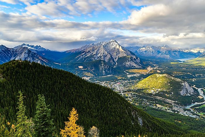
The oldest national park in Canada, Banff National Park was founded in 1885 in the Canadian Rockies. It has an area of 6,641 square km and is a treasure trove of some of Canada’s most pristine natural wealth. The Banff National Park is also famous for its surreal landscapes featuring mountains, glaciers, ice fields, dense forests, and more. Thus, it is not surprising that the Banff National Park welcomes nearly 3 million visitors each year. However, a heavy tourism rate also threatens the serenity of the area. The national park has three dominant ecoregions which are the montane, alpine, and subalpine. Grizzly bears, moose, elks, wolverine, and other mammalian species live in the park. Many species of birds also thrive here.

4. Elk Island National Park

#4 Elk Island National Park

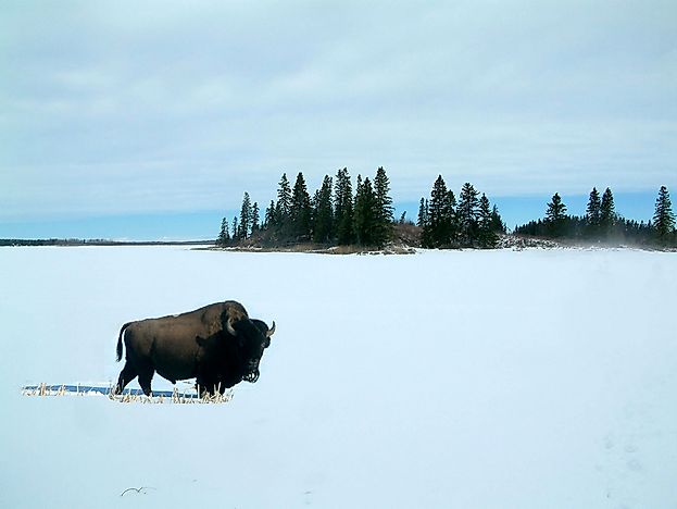
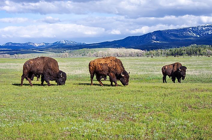
Located in Central Alberta, the Elk Island National Park is known for its important role in American bison conservation. The national park has an area of 194 square km. An interesting feature of this protected area is that it hosts the biggest and smallest species of terrestrial mammals in North America which is the wood bison and the pygmy shrew respectively. Several other species of mammals like the porcupine, mule deer, beaver, moose, etc., and birds such as American white pelicans, American bitterns, red-necked grebes, etc., also inhabit the Elk Island National Park.

3. Jasper National Park

#3 Jasper National Park

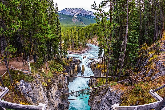
Alberta’s Jasper National Park is located to the west of Edmonton, the provincial capital of Alberta. The national park covers an area of 10,878 square km which makes it the largest national park in the Canadian Rockies. The park is well-known for its spectacular and interesting geographical features like snow-capped peaks, giant waterfalls, pristine blue lakes, and hot springs. The park was established as the Jasper Forest Park in 1907 and promoted to the status of a National Park in 1930. The species-rich national park hosts mammalian species like the grizzly bear, caribou, elk, timber wolf, cougar, and more. Birds thrive in this park and include species like red-necked grebes, golden eagles, bohemian waxwings, Canada geese, and more. Jasper National Park has been designated as a UNESCO World Heritage Site since 1984.

2. Waterton Lakes National Park

#2 Waterton Lakes National Park

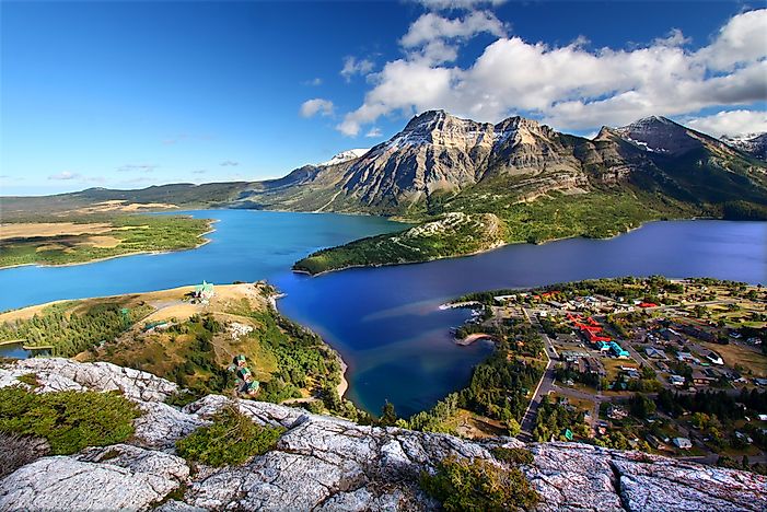
Named after the lake of the same name, the national park was established in 1895 and is located in Alberta’s southwest corner. The park has an area of 505 square km that features mountains and forests. The 2,910 m tall Mount Blakiston is the highest point of the national park. Some of the notable mammalian species found here are the grizzly bears, moose, white-tailed deer, black bears, bobcats, etc. The national park is part of a UNESCO World Heritage Site.

1. Wood Buffalo National Park

#1 Wood Buffalo National Park

Spanning an area of 44,807 square km, the Wood Buffalo National Park is the largest national park in the entire country and the second biggest in the world. The park’s territory encompasses parts of Northwest Territory and Alberta. The national park was founded in 1922 with the principal aim of conserving the wood bison, a near threatened species whose largest free-roaming herd lives in this area. The Wood Buffalo National Park is also a nesting site of the whooping cranes, North America’s tallest bird which is, unfortunately, an endangered species. The park is also home to one of the world’s biggest delta, the Peace-Athabasca Delta. UNESCO declared the Wood Buffalo National Park as a World Heritage Site in 1983.

How Many National Parks Does Alberta Have?

The Canadian province of Alberta has five national parks. These are Banff National Park, Elk Island National Park, Jasper National Park, Waterton Lakes National Park, and Wood Buffalo National Park.


source http://fourteen.online/the-five-spectacular-national-parks-of-alberta-canada/

from Dr. Linex https://ift.tt/2FdWI7w
via IFTTT

The Five Natural Asphalt Lake Areas In The World

The US state of California contains many asphalt lakes.

Asphalt lakes are tar pits that form when a type of petroleum called bitumen is forced from underground up to the Earth’s surface. Usually occurring along fault lines, the bitumen pools at the surface and the lighter elements vaporize, leaving a pool of natural asphalt. Mining for asphalt and tourism are important economic activities associated with such lakes. The world’s five known natural asphalt lake areas are highlighted below.

5. Pitch Lake

Pitch Lake is the largest natural asphalt deposit in the world. Located in the town of La Brea on the island nation of Trinidad and Tobago, the lake holds about 10 million tons of asphalt and is approximately 250 feet deep. Pitch Lake has a unique microbial diversity composed of both bacterial and archaeal colonies. Many new species of microbes have been discovered there, and even new species of fungi have been found in the lake. The lake is believed to exist at the intersection of two faults, and oil from deep underneath has seeped to the surface. When the more volatile and lighter compounds evaporate, the asphalt remains. Today, Pitch Lake is a popular tourist spot. A small museum has been built at Pitch Lake showcasing the history of the lake. Asphalt mining is also an important economic activity in the region.

4. La Brea Tar Pits

The La Brea Tar Pits are a group of tar pits located in Los Angeles, California, USA. The pits are the central feature of Hancock Park which was created in 1924. The oil that forms the tar pits seeps to the surface from the nearby Salt Lake Oil Field through the 6th Street Fault. The seeping oil forms pools in several locations in Hancock Park and becomes asphalt after the more volatile components of the oil evaporate. An interesting feature of the La Brea Tar Pits is the discovery of fossils from prehistoric species trapped in the asphalt. Over a period of centuries, the bones of these animals were preserved in the tar. A nearby museum preserves the fossils of these pre-historic species, including a saber-tooth cat, giant ground sloths, dire wolves, and turtles.

3. Lake Bermudez

Lake Bermudez, also known as Lake Guanoco, is a large asphalt lake located in Estado Sucre, Venezuela. Occupying an area of about 445 hectares, it is bigger than the Pitch Lake by area but smaller in terms of volume. The depth of Lake Bermudez varies between 4.9 feet and 6.6 feet. The asphalt from the lake has long been used by local indigenous populations, such as the Warao people who used it to waterproof canoes. Commercial mining of asphalt from the lake by a US company later occurred with permission from the Venezuelan government. The mining began in 1890, but soon created controversy and internal conflict within the country. Asphalt mining in the lake was stopped in 1934 and has not been resumed.

2. McKittrick Tar Pits

The McKittrick Tar Pits are a series of natural asphalt lakes located in Kern Country, California, USA. The existence of the tar pits has long been known by the indigenous populations, and the asphalt was used by locals for trade, decoration, and waterproofing. Commercial asphalt mining in the area started in the 1860s. The tar pits have also yielded significant paleontological information, since they preserved the bones of hundreds of animals from the Pleistocene Age.

1. Carpinteria Tar Pits

The Carpinteria Tar Pits are a series of asphalt lakes located in the southern part of Santa Barbara County, California, USA. The asphalt lakes are part of a designated park named Tar Pits Park. The tar pits are all located directly on the beach and are created by oil originating from the Carpinteria Offshore Oil Field. The asphalt was used by the indigenous population long before the arrival of Europeans, especially as a sealant to make their boats waterproof.


source http://fourteen.online/the-five-natural-asphalt-lake-areas-in-the-world/

from Dr. Linex https://ift.tt/35aACNv
via IFTTT

The Five Most Lightning Prone States In The United States

Florida is one of the country’s most lightning prone state.

The United States had 26 people die from lightning strikes in 2015. The months of June, July, and August represent the peak season of lightning strikes in the country, and the period when the majority of the deadly strikes were recorded. The states found in the southeast of the country are most prone to lightning strikes since they present the ideal conditions for the formation of thunderstorms, the meeting of cool air from the west with warm air from the Gulf of Mexico.

Top Five Most Lightning Prone US States

Florida

Florida leads as the most lightning-prone state in the country, as it experiences an average 25.3 lightning strikes for every square mile. The state witnesses an average of 1.45 million lightning strikes each year, the highest in the country. More than 62 deaths have been recorded over the past decade, which is attributed to lightning strikes. The location of the state is to blame for its high incidents of lightning. Florida sits between the Atlantic and Gulf coasts and the sea breezes combined with the tropical heat and humidity make the ideal conditions for thunderstorms.

Louisiana

Louisiana experiences an average of 0.942 million lightning strikes each year. While Oklahoma exceeds the annual number of lightning strikes, Louisiana is recognized as second in America’s most lightning-prone states due to the high intensity of strikes; 20.3 strikes for every square mile. Lightning strikes have killed nine people in Louisiana in the past ten years. Four of the deaths were recorded in 2016, which was, according to some meteorologists, one of the deadliest in the recent past.

Mississippi

In July 2018, a church in Mississippi which had stood for about two centuries went up in flames after it was struck by lightning. The lightning strike that destroyed the historic church was one of the more than 0.856 million lightning strikes recorded each year in the third-most lightning-prone state in the country. Mississippi records an average of 18 lightning strikes for every square mile per year. Lightning strikes have caused ten deaths in the state over the past decade.

Alabama

Alabama is recognized as among the states most prone to lightning in the United States. More than 0.824 million strikes are recorded in Alabama each year, translating to about 15.9 lightning strikes for every square mile. Lightning strikes have caused the deaths of 17 people over the last ten years in Alabama, which is more than the lightning fatalities recorded in Mississippi and Louisiana over the same period. This statistic makes Alabama one of the deadliest states in the country in lightning fatalities.

South Carolina/ Oklahoma

Oklahoma and South Carolina are tied as the fifth-most lightning prone states in the country, each having 14.6 strikes for every square mile annually. However, the total number of strikes recorded each year is higher in Oklahoma which has over 1.017 million strikes each year, compared to the over 0.451 million strikes recorded in South Carolina annually. South Carolina experiences more fatalities of the two states, with 12 people being fatally struck over the past decade. In contrast, Oklahoma had only four fatal strikes over the same period.

Deadliest States in Lightning Fatalities

Florida and Louisiana are the most prone to lightning strikes in the country. The two states are also the most dangerous in lightning fatalities. 142 people have been killed by lightning strikes in Louisiana since 1959 while Florida has witnessed 477 fatal strikes over the same period. Scientists believe that the high number of deaths in the two states is caused by the lightning season correlating with the period when there are increased outdoor activities.


source http://fourteen.online/the-five-most-lightning-prone-states-in-the-united-states/

from Dr. Linex https://ift.tt/2F8PNMI
via IFTTT

The Five Geographical Zones Of The World

The Earth’s five main latitude zones comprise of five geographical zones: the North Frigid Zone, the North Temperate Zone, the South Temperate Zone, the Torrid Zone, and the South Frigid Zone.

The earth is divided into five distinct zones based on their climatic conditions, known as geographical zones. These zones are the North Frigid Zone, the North Temperate Zone, the Tropics, the South Frigid Zone, and the South Temperate Zone. The two temperate zones (the North and South Temperate Zones) share the same climatic characteristics, with their only difference being the location of each with regards to the tropics. The same can be said of the North and South Frigid Zone. Latitudes act as the boundaries separating the geographical zones from each other.

The North Frigid Zone

The North Frigid Zone sits on the northernmost part of the globe and is characterized by freezing temperatures and long winters. The zone comprises of all regions that lie north of the 66.5 degrees north latitude. Among the regions under the geographical zone include Alaska, Greenland, Northern Russia, Finland, Iceland, Sweden, and the Arctic Ocean. Due to the extreme conditions experienced in the Arctic, the zone is largely uninhabited. However, there are a few people who are recognized as indigenous residents of the Arctic, and these include the Inuit, Yupik, Evenks, Chukchi, Nenets, and Yukaghir.

The biosphere of the North Frigid Zone is adapted to cope with the extreme weather conditions found in this geographical zone. The freezing temperatures and limited sunshine prevent the growth of trees in the Arctic and plants rarely grow to over six feet tall. Mosses, herbs, lichens, and dwarf shrubs make up the vegetation found in the Arctic. Examples of animals native to this geographical zone include herbivores such as the Muskox, the caribou, and the Arctic hare. Predators include the polar bear, killer whales, and the Arctic fox. The fundamental issue being faced in the North Frigid Zone geographical zone is the melting of ice caused by global warming, which is expected to have devastating consequences on the zone’s biosphere.

The North And South Temperate Zones

South of the Arctic geographical zone and north of the Antarctic geographical zone lies the temperate geographical zone. The tropics divides the temperate zone into two, the northern temperate zone, and the southern temperate zone. The two zones are named based on their location concerning the tropics. The northern temperate zone is found between the 66.50 North and 23.50 North latitudes while the southern temperate zone lies between the 66.50 South and 23.50 South latitudes. The zone is characterized by distinct seasonal changes where the four seasons are well defined throughout the year, and wide temperature ranges. When combined, the North and South temperate zones account for over 50% of the planet’s surface, covering most of Europe, North America, and Asia, and part of South America, Africa, and Oceania. The temperate geographical zone is made up of five subzones which are the oceanic, subtropical, continental, Boreal, and Mediterranean subzones. The Himalayas are a distinctive geological feature found on the temperate zone, as are the Alps and the Rockies.

All of the world’s temperate forests, which are among the largest ecological habitats, are found in the temperate zone. The forests are home to numerous animal species including hundreds of bird species, cougars, wolves, deer, and foxes. Due to its diversity, the geographical zone is home to the majority of the global human population. The zone also features many of the world’s largest cities, which is an indication of the rapid urbanization rate recorded in the temperate geographical zone. A reason behind the large human settlement in the temperate zone is because it lies on some of the most agriculturally productive regions in the world. Large-scale farming of the world’s most important grains is on the temperate zones.

The Torrid Zone

Also known as the Torrid Zone, the tropics represent the geographical zone closest to the equator which lies between the Tropic of Cancer and Tropic of Capricorn. The tropics are an extremely diverse region in numerous aspects including demographically, biologically, and ecologically. However, one characteristic which defines these different regions is that the Sun passes the zenith at least once annually. Some scholars categorize the torrid zone into two distinct regions based on their locations on the globe; neotropics which are found in the western hemisphere (Latin America and the Caribbean), and paleotropics which are found in the eastern hemisphere (Australia, Africa, and Asia). Majority of the areas that fall under the tropics experience two seasons each year; the wet season and dry season.

The Torrid Zone represents the largest geographical zone on earth, covering an estimated 40% of the planet’s area. An estimated 40% of the earth’s total population resides in the tropics, with the figure being projected to rise to reach 50% of the global population by 2040. Most people picture the tropics to be lush jungles with towering trees. While such a botanic composition can, indeed, be found in the tropical rainforests which are found in the Torrid Zone, the geographic zone also features other contrasting habitats ranging from towering mountains such as the Andes and Mount Kilimanjaro to expansive deserts such as the Sahara and Atacama Deserts. The Torrid Zone is arguably the richest of the five geographical zones, with its habitats supporting more animal and plant species than any other zone.

The South Frigid Zone

The southern-most geographical zone is the South Frigid Zone. Like the North Frigid Zone, this geographical zone is characterized by freezing temperatures and having the midnight sun; a single day when the sun remains visible for 24 hours. All regions found between the 66.50 South latitude and the South Pole are classified under the South Frigid Zone. This geographical zone covers 4.12% of the planet’s surface, making it tie with the North Frigid Zone as the smallest of the world’s five geographical zones. Antarctica represents the bulk of the South Frigid Zone.

Temperatures experienced in the South Frigid Zone are among the lowest on earth. The extreme temperatures and harsh weather conditions experienced in the South Frigid Zone sparsely inhabited with human settlement. However, Antarctica is home to a population of people, most of whom are researchers who only live on the continent temporarily.

The post The Five Geographical Zones Of The World appeared first on Gradaxis.


source http://gradaxis.com/the-five-geographical-zones-of-the-world/

from Dr. Linex https://ift.tt/2ZHIx3L
via IFTTT

Tuesday, December 31, 2019

Acetaminophen and Codeine : Uses, Side Effects, Interactions & More

The combination of acetaminophen and codeine may be habit forming, especially with prolonged use. Take acetaminophen and codeine exactly as directed. Do not take more of it, take it more often, or take it in a different way than directed by your doctor. While taking acetaminophen and codeine, discuss with your health care provider your pain treatment goals, length of treatment, and other ways to...

Source


source https://www.drlinex.com/acetaminophen-and-codeine-uses-side-effects-interactions-more/

from Dr. Linex https://ift.tt/36eS1pR
via IFTTT