The average locations in Nepal and Bhutan lie in the sky more than 2 miles above sea level.
These countries are those in the world with the highest average topographical elevation of all of the landmasses within their respective borders. Though Himalayan countries top the list, it includes countries from Asia, Europe, Africa, Antarctica, and South America alike.
10. China (6,035)
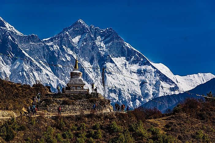
The Tibetan Plateau, also referred to as the ‘Roof of the World’ is the highest part of China with elevations more than 5,000 feet above sea level. The world’s tallest peak above sea level, the Mount Everest (pictured), also lies at the Sino-Nepal border. Besides these well-known topographical regions, China has high elevations over much of its topography with the average elevation of the country being 6,035 feet above sea level.
9. Chile (6,140 feet)
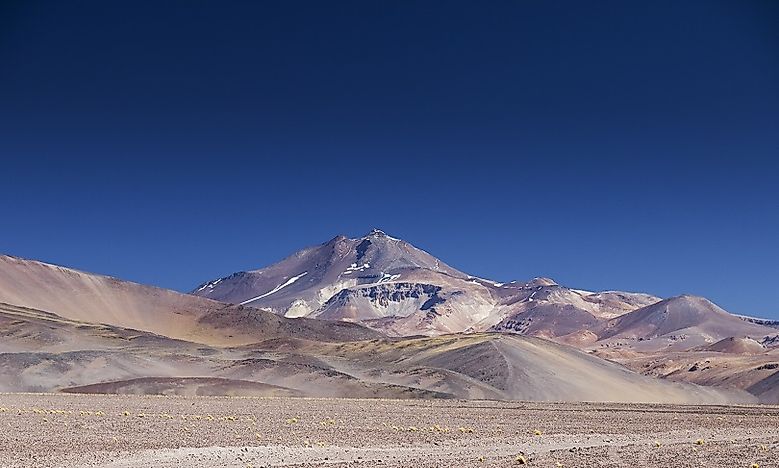
Chile has an overall elevated topography with an average elevation of 6,140 feet above sea level. The lofty Andean cordillera in the east and the low coastal mountains on the west contributes to the elevated topography of the country. The Andes has peaks with an average height of 15,000 feet above sea level. Pictured: Ojos del Salado.
8. Afghanistan (6,180 feet)
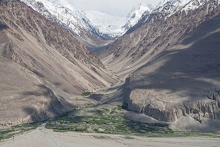
The landlocked country of Afghanistan has a terrain that is about 75% mountainous. 49% of the country has an average altitude of 6,650 feet while the average elevation for the entire country is 6,180 feet above sea level. The highest mountains of Afghanistan include the Hindu Kush, considered to be extensions of the Himalayas, which run across the country from north-east to south-west. The highest peaks of Hindu Kush lie in the Wakhan Corridor (pictured).
7. Andorra (6,550 feet)
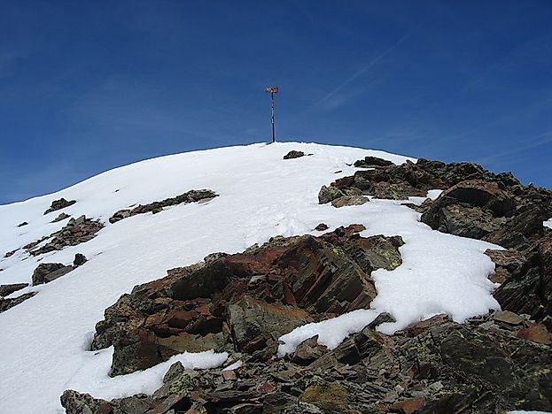
One of the world’s smallest countries, Andorra is located in southwestern Europe with rugged mountains occupying most of its territory. The Pyrenees Mountains spread across the country with small, narrow valleys in between the mountain ranges. The Pic de Coma Pedrosa (pictured) is the highest point in the country with at an altitude of 9,665 feet. The average elevation of the country is 6,650 feet above sea level.
6. Lesotho (7,090 feet)
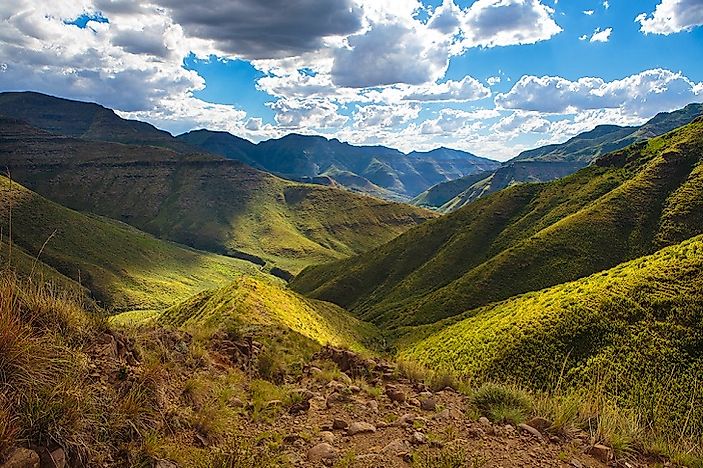
The Drakensberg-Maloti mountain ranges cover much of Lesotho’s topography. The highest peak of southern Africa, the Thabana–Ntlenyana, also lies in eastern Lesotho. The mountain ranges run from north to south of the country with the land descending gradually westward. It is in the lowlands of Lesotho, however, that two-thirds of the population live and practice agriculture. The average elevation of the African nation is 7,090 feet above sea level.
5. Antarctica (7,545 feet)
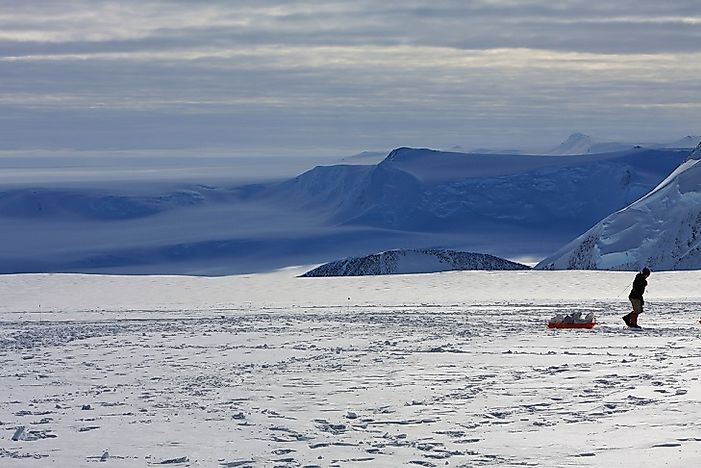
Though not a country but a continent, Antarctica’s name is worth mentioning on this list. It is the highest continent on the planet with an average elevation of 7,545 feet above sea level. The elevation of Antarctica at the South Pole is 9,300 feet. The highest point on the continent’s icecap of lies in the Australian Antarctic Territory with an altitude of 13,451 feet. The tallest mountain peak in Antarctica is Mount Vinson (pictured) which lies at a height of 16,050 feet.
4. Kyrgyzstan (9,805 feet)
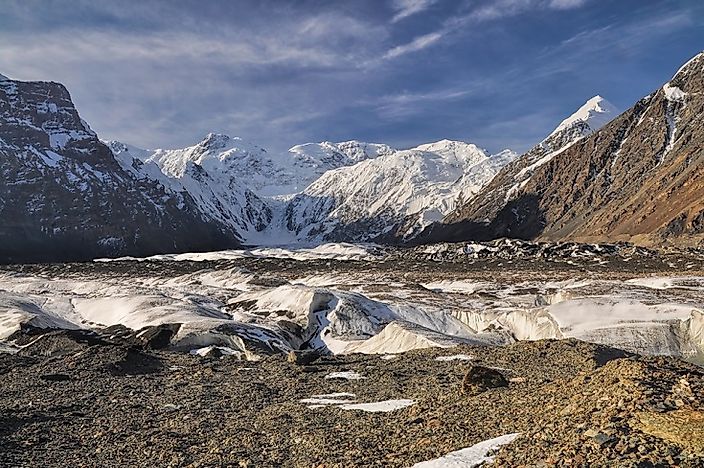
The topography of Kyrgyzstan is riddled with relatively young, mountain ranges with tall, sharp peaks separated by deep valleys. The Tian Shan and Pamir mountain ranges occupy 65% of the country’s terrain. There are also large glaciers in the region with the largest one being the Engilchek Glacier (pictured). The average elevation of the country is 9,805 feet above sea level.
3. Tajikistan (10,455 feet)
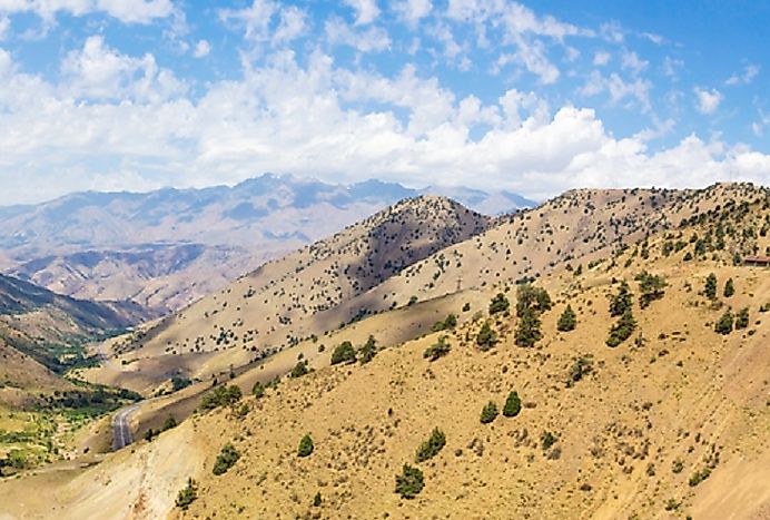
Much of Tajikistan lies well above sea level, including the lowlands of the country in the (pictured). The maximum elevation of the Turkestan Range, the highest mountain range in western Tajikistan, is 18,077 feet. The average elevation of the entire country is about 10,455 feet above sea level. Since Tajikistan lies in a seismic belt, incidents involving earthquakes are not uncommon in this region.
2. Nepal (10,715 feet)
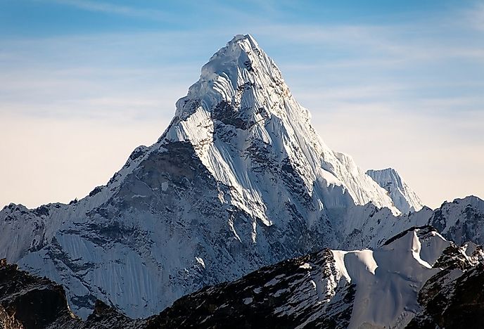
Nepal ranks second in the world in terms of average elevation above sea level, which is 10,715 feet for the nation as a whole. The country has a varied topography, with the flat, Gangetic River plain to the south, a hilly central region, and a northern mountainous region. The latter is dominated by some of the world’s highest peaks, including Mount Everest (29,035 feet), the tallest peak in the world. Pictured is Nepal’s Ama Dablam.
1. Bhutan (10,760 feet)
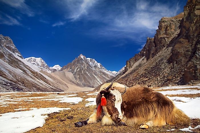
Northern parts of Bhutan are dominated by tall, sharp peaks of the Greater Himalayas, with the Gangkhar Puensum being the highest point in the country. This mountain, with a peak at 24,840 feet above sea level, is considered by many to be the highest unclimbed mountain in the world. The Bhutanese climate and topography have made the farming of domesticated, mountain-loving yaks (pictured), alongside other agricultural commodities suitable for the Himalaya, an important economic activity. The southern parts of Bhutan comprise the hilly areas, highlands, and valleys where most of the Bhutanese population of the country reside. Bhutan ranks number one in the world in terms of average land elevation above sea level (10,760 feet).
Which Countries Have the Highest Elevations?
Bhutan, Nepal, and Tajikistan are the countries with the highest elevations. However, the Tibetan Plateau, which is part of China, is often referred to as “the Roof of the World”.
The post Top 10 Countries With The Highest Average Elevations appeared first on Gradaxis.
source http://gradaxis.com/top-10-countries-with-the-highest-average-elevations/
from Dr. Linex https://ift.tt/2MxGMRy
via IFTTT
0 comments:
Post a Comment